File:Map of Nicobar and Andaman Islands-en.svg
Jump to navigation
Jump to search

Size of this PNG preview of this SVG file: 263 × 598 pixels. Other resolutions: 105 × 240 pixels | 211 × 480 pixels | 337 × 768 pixels | 450 × 1,024 pixels | 900 × 2,048 pixels | 906 × 2,060 pixels.
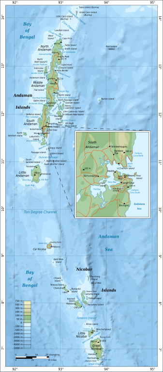
Original file (SVG file, nominally 906 × 2,060 pixels, file size: 621 KB)
File history
Click on a date/time to view the file as it appeared at that time.
| Date/Time | Thumbnail | Dimensions | User | Comment | |
|---|---|---|---|---|---|
| current | 16:24, 15 September 2010 | | 906 × 2,060 (621 KB) | commons>Mysid | {{Information |Description={{en|1=Map of the Nicobar and Andaman Islands.}} |Source={{own}}. Self-made in Inkscape. Based on the 1976 CIA Indian Ocean Atlas (File:Andaman nicobar 76.jpg); bathymetry and topography from SRTM30_PLUS. |Author=[[w:User:M |
File usage
There are no pages that use this file.