File:Map of Middlesex.jpg
Jump to navigation
Jump to search

Size of this preview: 765 × 599 pixels. Other resolutions: 306 × 240 pixels | 613 × 480 pixels | 980 × 768 pixels | 1,280 × 1,003 pixels | 1,524 × 1,194 pixels.
Original file (1,524 × 1,194 pixels, file size: 520 KB, MIME type: image/jpeg)
File history
Click on a date/time to view the file as it appeared at that time.
| Date/Time | Thumbnail | Dimensions | User | Comment | |
|---|---|---|---|---|---|
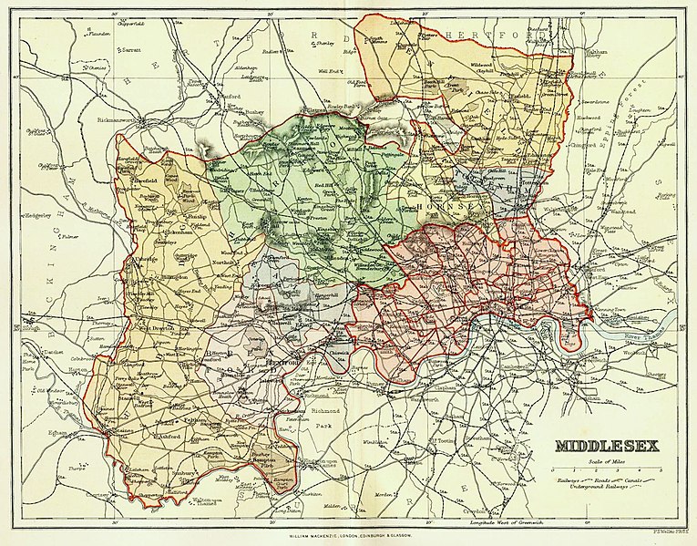
| current | 14:55, 19 July 2018 | | 1,524 × 1,194 (520 KB) | commons>Celia Homeford | ==Summary== {{Information |description=Colour engraving of a map of the County of Middlesex, England, by F. S. Weller published by William Mackenzie in ''The Comprehensive Gazetteer of England and Wales'', {{circa|1891-95}}. Includes areas transferred to new County of London in 1889 and areas that remained part of the administrative county until its abolition in 1965. |author=Engraved by F. S. Weller (1849-1910); published by William Mackenzie |source = www.middx.net |date={{circa|1891-95}} }... |
File usage
There are no pages that use this file.