File:Map of German troop disposition around Saint-Quentin on 22 April 1917.jpg
Jump to navigation
Jump to search

Size of this preview: 749 × 599 pixels. Other resolutions: 300 × 240 pixels | 600 × 480 pixels | 960 × 768 pixels | 1,280 × 1,024 pixels | 2,560 × 2,048 pixels | 2,951 × 2,361 pixels.
Original file (2,951 × 2,361 pixels, file size: 4.25 MB, MIME type: image/jpeg)
File history
Click on a date/time to view the file as it appeared at that time.
| Date/Time | Thumbnail | Dimensions | User | Comment | |
|---|---|---|---|---|---|
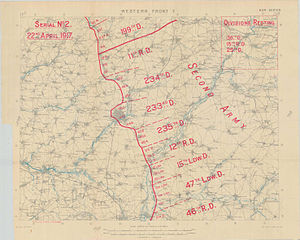
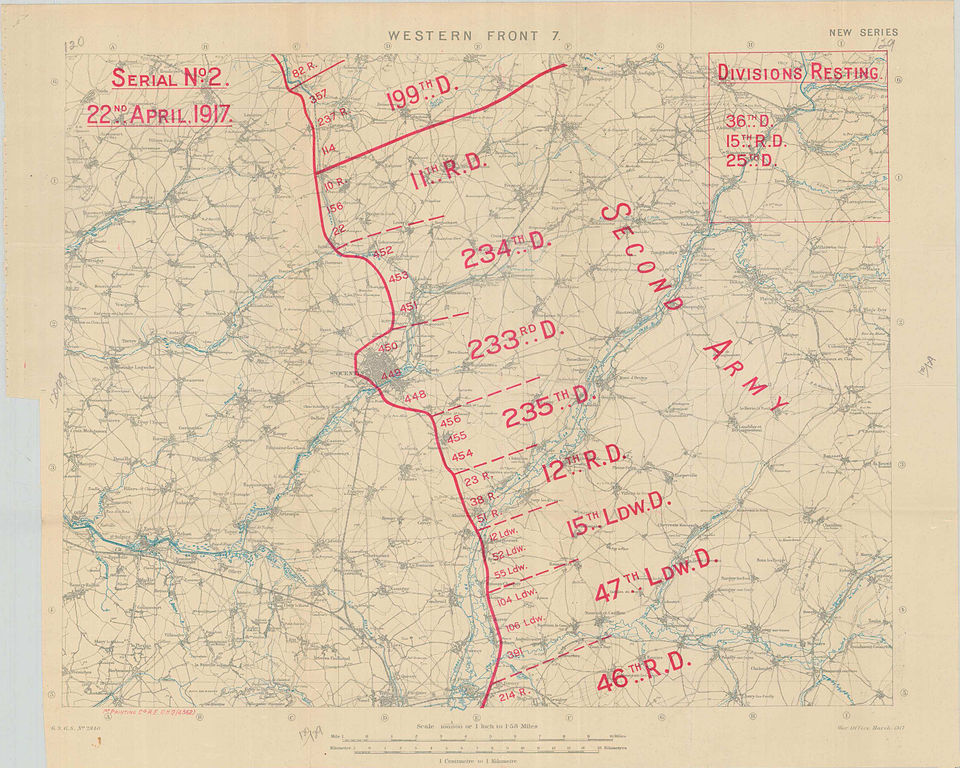
| current | 16:56, 19 August 2012 | | 2,951 × 2,361 (4.25 MB) | commons>Labattblueboy | {{Information |Description= Disposition of German troops on 22 April 1917, between La Fere and Gouy. Focus is placed on Saint-Quentin. |Source=Exerpt from Australian War Memorial (www.awm.gov.au)<br>War diary awm4-1-30-15 part3, page 28 |Date= April 1... |
File usage
There are no pages that use this file.