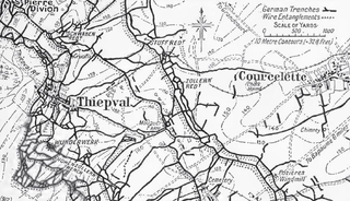
File:Map of German defensive fortifications from Thiepval to Courcelette, July 1916.png
Jump to navigation
Jump to search

Size of this preview: 800 × 459 pixels. Other resolutions: 320 × 184 pixels | 640 × 367 pixels | 864 × 496 pixels.
Original file (864 × 496 pixels, file size: 478 KB, MIME type: image/png)
File history
Click on a date/time to view the file as it appeared at that time.
| Date/Time | Thumbnail | Dimensions | User | Comment | |
|---|---|---|---|---|---|
| current | 23:18, 19 September 2014 | | 864 × 496 (478 KB) | commons>Keith-264 | User created page with UploadWizard |
File usage
There are no pages that use this file.