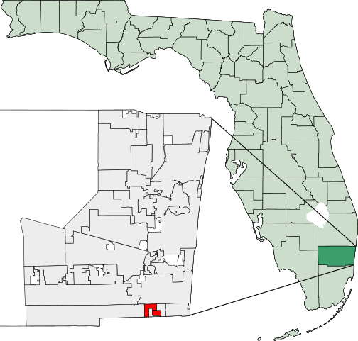
File:Map of Florida highlighting West Park.svg
Jump to navigation
Jump to search

Size of this PNG preview of this SVG file: 450 × 429 pixels. Other resolutions: 252 × 240 pixels | 504 × 480 pixels | 806 × 768 pixels | 1,074 × 1,024 pixels | 2,148 × 2,048 pixels.
Original file (SVG file, nominally 450 × 429 pixels, file size: 1.17 MB)
File history
Click on a date/time to view the file as it appeared at that time.
| Date/Time | Thumbnail | Dimensions | User | Comment | |
|---|---|---|---|---|---|
| current | 03:15, 8 March 2007 | | 450 × 429 (1.17 MB) | commons>Bastique | {{coor dms|25|59|00|N|80|11|11|W}} Created using coordinate data from US Census Bureau, modified in accordance with incorporation data from 2000-2005 in Adobe Illustrator. {{GDFL}} [[Category:Maps of Broward County, |
File usage
There are no pages that use this file.