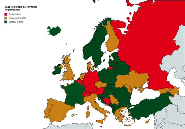
File:Map of Europe by territorial organisation 2.png
Jump to navigation
Jump to search

Size of this preview: 800 × 557 pixels. Other resolutions: 320 × 223 pixels | 640 × 446 pixels | 1,024 × 713 pixels.
Original file (1,024 × 713 pixels, file size: 233 KB, MIME type: image/png)
File history
Click on a date/time to view the file as it appeared at that time.
| Date/Time | Thumbnail | Dimensions | User | Comment | |
|---|---|---|---|---|---|
| current | 00:22, 25 August 2019 | | 1,024 × 713 (233 KB) | commons>Riba | Correction of an important mistake: depicting France as a "devolved country" does not reflect the reality. France is an important unitary state. |
File usage
There are no pages that use this file.