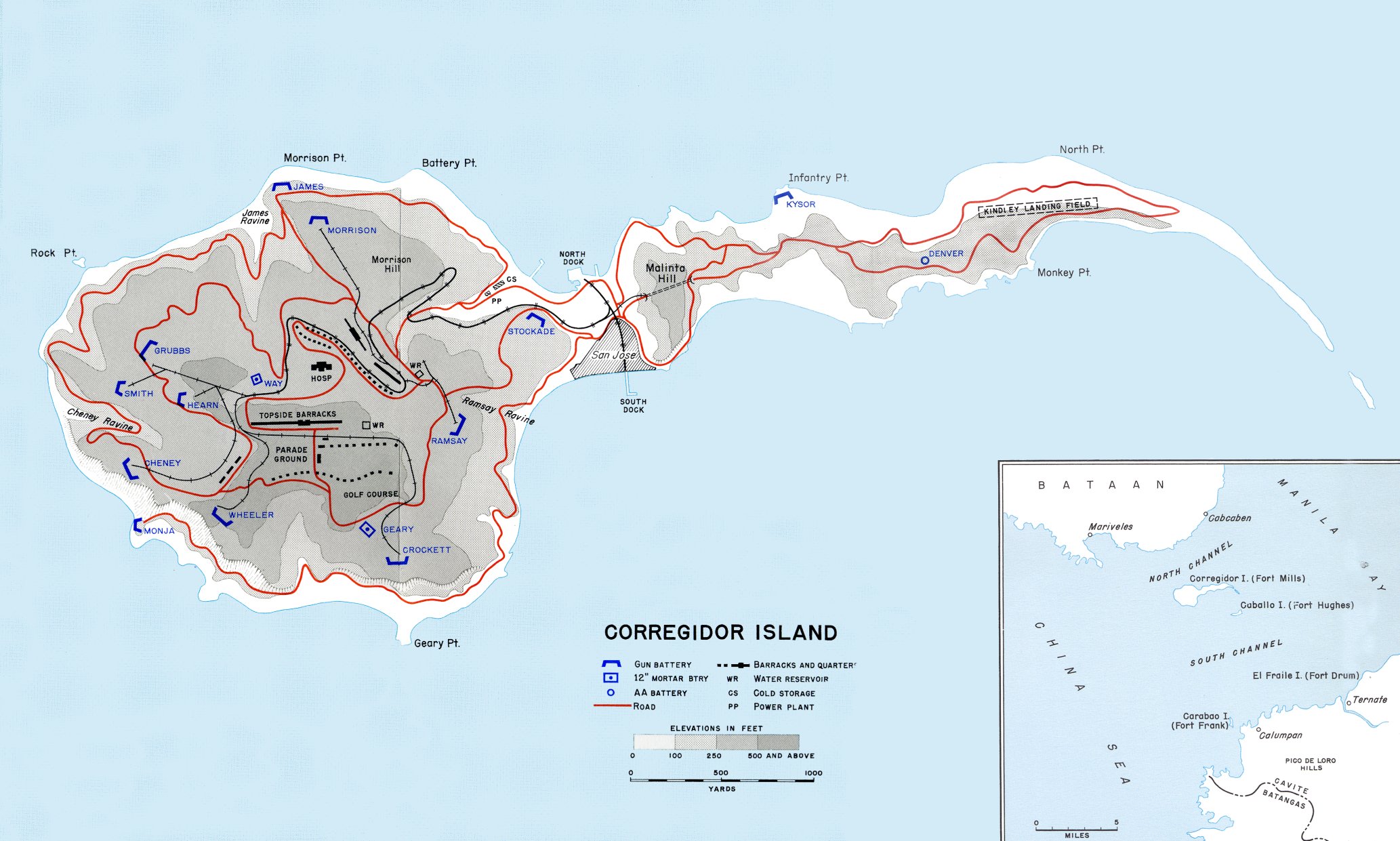
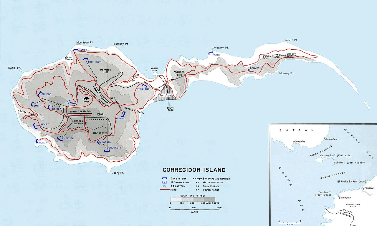
File:Map of Corregidor 1941.jpg
Jump to navigation
Jump to search
Size of this preview: 800 × 481 pixels. Other resolutions: 320 × 192 pixels | 640 × 384 pixels | 1,024 × 615 pixels | 1,280 × 769 pixels | 2,066 × 1,241 pixels.
Original file (2,066 × 1,241 pixels, file size: 368 KB, MIME type: image/jpeg)
File history
Click on a date/time to view the file as it appeared at that time.
| Date/Time | Thumbnail | Dimensions | User | Comment | |
|---|---|---|---|---|---|
| current | 03:03, 22 August 2006 | | 2,066 × 1,241 (368 KB) | commons>Balcer~commonswiki | Map of Corregidor island in 1941. Source: [http://www.army.mil/cmh/books/wwii/5-2/Notes/Map23.jpg] [http://www.army.mil/cmh/books/wwii/5-2/5-2_Contents.htm] {{PD-USGov-Military-Army}} Category:Maps of World War II in the Pacific |
File usage
There are no pages that use this file.