File:Map of Colchis, Iberia, Albania, and the neighbouring countries ca 1770.jpg
Jump to navigation
Jump to search

Size of this preview: 800 × 598 pixels. Other resolutions: 320 × 239 pixels | 640 × 479 pixels | 1,016 × 760 pixels.
Original file (1,016 × 760 pixels, file size: 194 KB, MIME type: image/jpeg)
File history
Click on a date/time to view the file as it appeared at that time.
| Date/Time | Thumbnail | Dimensions | User | Comment | |
|---|---|---|---|---|---|
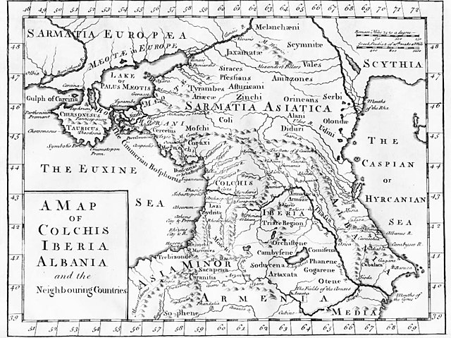
| current | 16:02, 22 October 2008 | | 1,016 × 760 (194 KB) | commons>BetacommandBot | move approved by: User:Deadstar This image was moved from Image:1729.jpg {{Information |Description = "A Map of Colchis, Iberia, Albania, and the neighbouring countries". A map of the Caucasus / Crimea / southern Russia region during classical |
File usage
There are no pages that use this file.