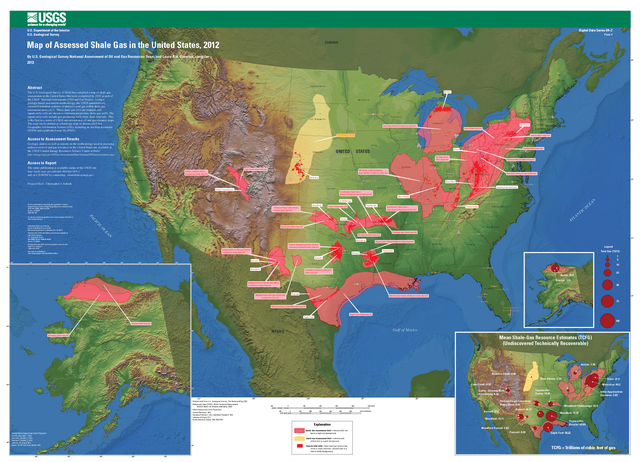
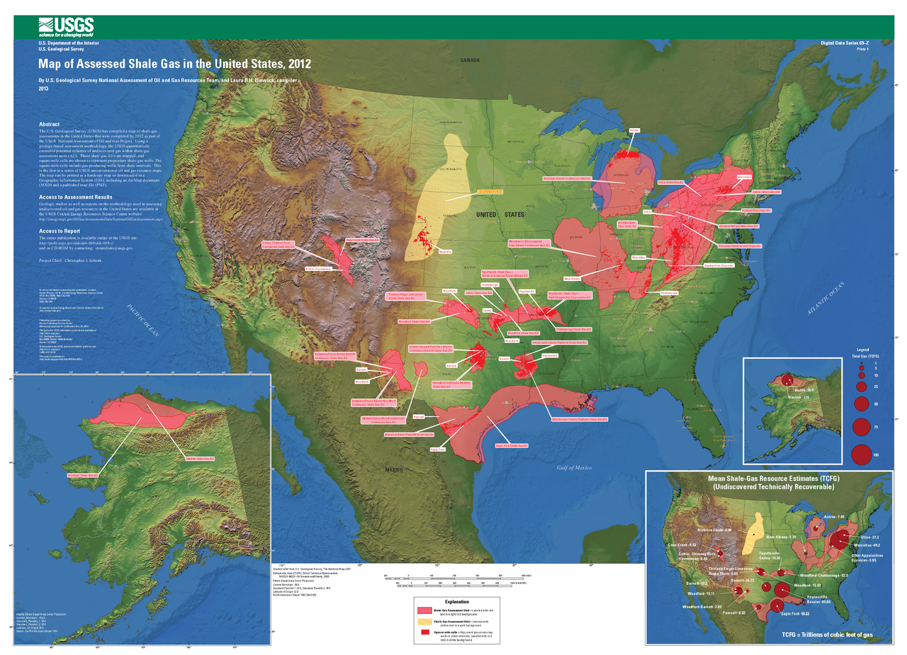
File:Map of Assessed Shale Gas in the United States, 2012.png
Jump to navigation
Jump to search

Size of this preview: 800 × 578 pixels. Other resolutions: 320 × 231 pixels | 640 × 462 pixels | 1,024 × 740 pixels | 1,280 × 925 pixels | 2,560 × 1,849 pixels | 3,637 × 2,627 pixels.
Original file (3,637 × 2,627 pixels, file size: 12.29 MB, MIME type: image/png)
File history
Click on a date/time to view the file as it appeared at that time.
| Date/Time | Thumbnail | Dimensions | User | Comment | |
|---|---|---|---|---|---|
| current | 09:01, 24 December 2014 | | 3,637 × 2,627 (12.29 MB) | commons>Anna Frodesiak | full res |
File usage
There are no pages that use this file.