File:Map indicating Foxe Basin, Nunavut, Canada.png
Jump to navigation
Jump to search
No higher resolution available.
Map_indicating_Foxe_Basin,_Nunavut,_Canada.png (360 × 330 pixels, file size: 47 KB, MIME type: image/png)
File history
Click on a date/time to view the file as it appeared at that time.
| Date/Time | Thumbnail | Dimensions | User | Comment | |
|---|---|---|---|---|---|
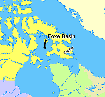
| current | 14:31, 21 March 2006 | | 360 × 330 (47 KB) | commons>David Kernow~commonswiki | == Summary == Map indicating Foxe Basin, Nunavut, Canada. {{legend|#ffff66|Nunavut}} {{legend|#ffffcc|Greenland}} {{legend|#d5fe94|Quebec}} {{legend|#ecebb6|Newfoundland and Labrador}} {{legend|#ccccff|Manitoba}} {{legend|#ffcccc|Ontario |
File usage
There are no pages that use this file.