File:Map highlighting Gale Township, Marion County, Kansas.svg
Jump to navigation
Jump to search

Size of this PNG preview of this SVG file: 600 × 600 pixels. Other resolutions: 240 × 240 pixels | 480 × 480 pixels | 768 × 768 pixels | 1,024 × 1,024 pixels | 2,048 × 2,048 pixels.
Original file (SVG file, nominally 768 × 768 pixels, file size: 32 KB)
File history
Click on a date/time to view the file as it appeared at that time.
| Date/Time | Thumbnail | Dimensions | User | Comment | |
|---|---|---|---|---|---|
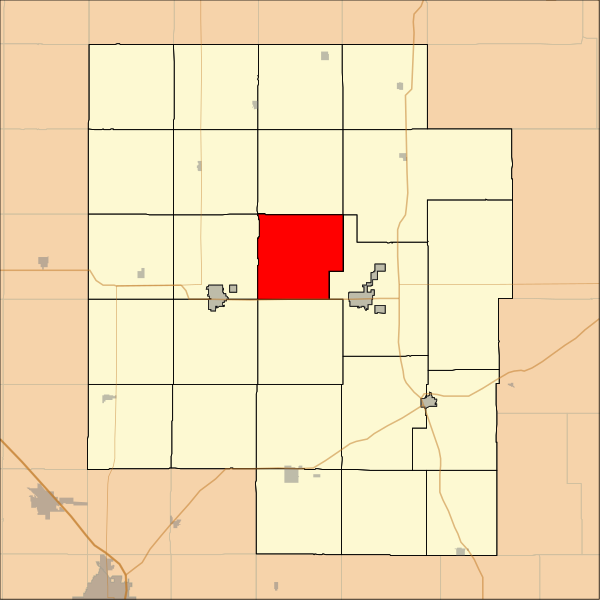
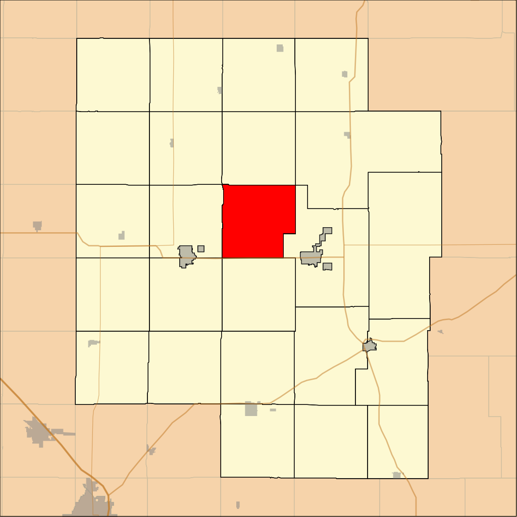
| current | 03:48, 7 May 2009 | | 768 × 768 (32 KB) | commons>File Upload Bot (Omnedon) | == Summary == {{Information |Description={{en|This is a map of Marion County, Kansas, USA which highlights the location of Gale Township.}} |Source==My own work, using custom-writte |
File usage
There are no pages that use this file.