File:Map borderline at sea Norway Russia.gif
Jump to navigation
Jump to search
Size of this preview: 384 × 599 pixels. Other resolutions: 154 × 240 pixels | 308 × 480 pixels | 709 × 1,106 pixels.
Original file (709 × 1,106 pixels, file size: 265 KB, MIME type: image/gif)
File history
Click on a date/time to view the file as it appeared at that time.
| Date/Time | Thumbnail | Dimensions | User | Comment | |
|---|---|---|---|---|---|
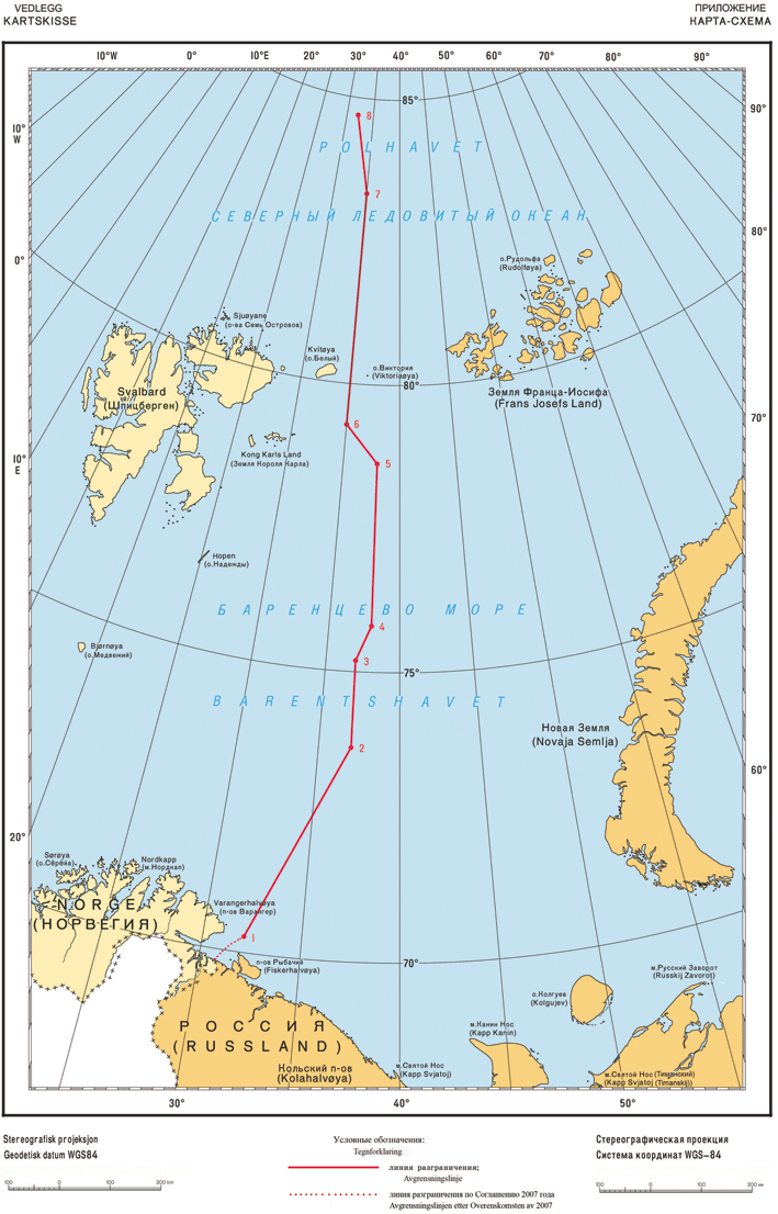
| current | 15:57, 8 June 2011 | | 709 × 1,106 (265 KB) | commons>Gryphonis | {{Information |Description={{no|Delelinjen i Barentshavet.}} |Source=Own work, based upon [http://www.regjeringen.no/upload/UD/Vedlegg/Folkerett/100914_Kartskisse_final.pdf Norwegian State Departement.] |Date=2011-06-08 |Author=[[User: |
File usage
There are no pages that use this file.