File:Map Widerøe Flight 933.png
Jump to navigation
Jump to search
No higher resolution available.
Map_Widerøe_Flight_933.png (562 × 332 pixels, file size: 159 KB, MIME type: image/png)
File history
Click on a date/time to view the file as it appeared at that time.
| Date/Time | Thumbnail | Dimensions | User | Comment | |
|---|---|---|---|---|---|
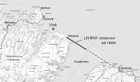
| current | 08:03, 21 October 2012 | | 562 × 332 (159 KB) | commons>Arsenikk | {{Information |Description={{en|Map of the flight path of Widerøe Flight 933. The thick line is the part observed by radar; "vrak" marks the location of the wreck.}} {{no|Banen til WF933 (Mehamn-ulykken). Den tykke linjen er det som er fulgt på radar... |
File usage
There are no pages that use this file.