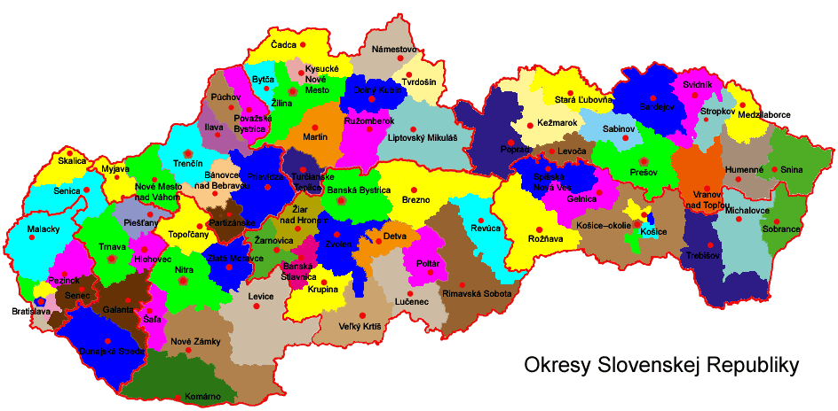
File:Map Slovakia districts 2004.png
Jump to navigation
Jump to search
Size of this preview: 800 × 393 pixels. Other resolutions: 320 × 157 pixels | 944 × 464 pixels.
Original file (944 × 464 pixels, file size: 54 KB, MIME type: image/png)
File history
Click on a date/time to view the file as it appeared at that time.
| Date/Time | Thumbnail | Dimensions | User | Comment | |
|---|---|---|---|---|---|
| current | 15:29, 14 September 2005 | | 944 × 464 (54 KB) | commons>PM | Slovakia divided into districts (as of 2004) From Obrázok:Slovensko okresy.png at sk:wiki. |
File usage
There are no pages that use this file.