File:Map Saint Pierre et Miquelon.svg
Jump to navigation
Jump to search

Size of this PNG preview of this SVG file: 591 × 368 pixels. Other resolutions: 320 × 199 pixels | 640 × 399 pixels | 1,024 × 638 pixels | 1,280 × 797 pixels | 2,560 × 1,594 pixels.
Original file (SVG file, nominally 591 × 368 pixels, file size: 17 KB)
File history
Click on a date/time to view the file as it appeared at that time.
| Date/Time | Thumbnail | Dimensions | User | Comment | |
|---|---|---|---|---|---|
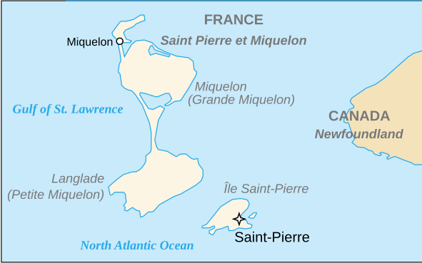
| current | 19:32, 3 August 2018 | | 591 × 368 (17 KB) | commons>De728631 | {{Information |Description={{en|Map of Saint Pierre et Miquelon}} |Source={{own}} – {{derived from|Saint Pierre et Miquelon Map.svg}} |Date=2018-08-03 |Author= *{{derivative}} De728631 *Saint Pierre et Miquelon Map.svg: Planiglobe, RaviC |Permission= |other_versions= }} Category:SVG maps of Saint-Pierre and Miquelon Category:SVG maps in English |
File usage
There are no pages that use this file.