File:Map-Prussia-LowerSilesia.png
Jump to navigation
Jump to search
Size of this preview: 706 × 599 pixels. Other resolutions: 283 × 240 pixels | 565 × 480 pixels | 905 × 768 pixels | 1,206 × 1,024 pixels | 1,750 × 1,486 pixels.
Original file (1,750 × 1,486 pixels, file size: 140 KB, MIME type: image/png)
File history
Click on a date/time to view the file as it appeared at that time.
| Date/Time | Thumbnail | Dimensions | User | Comment | |
|---|---|---|---|---|---|
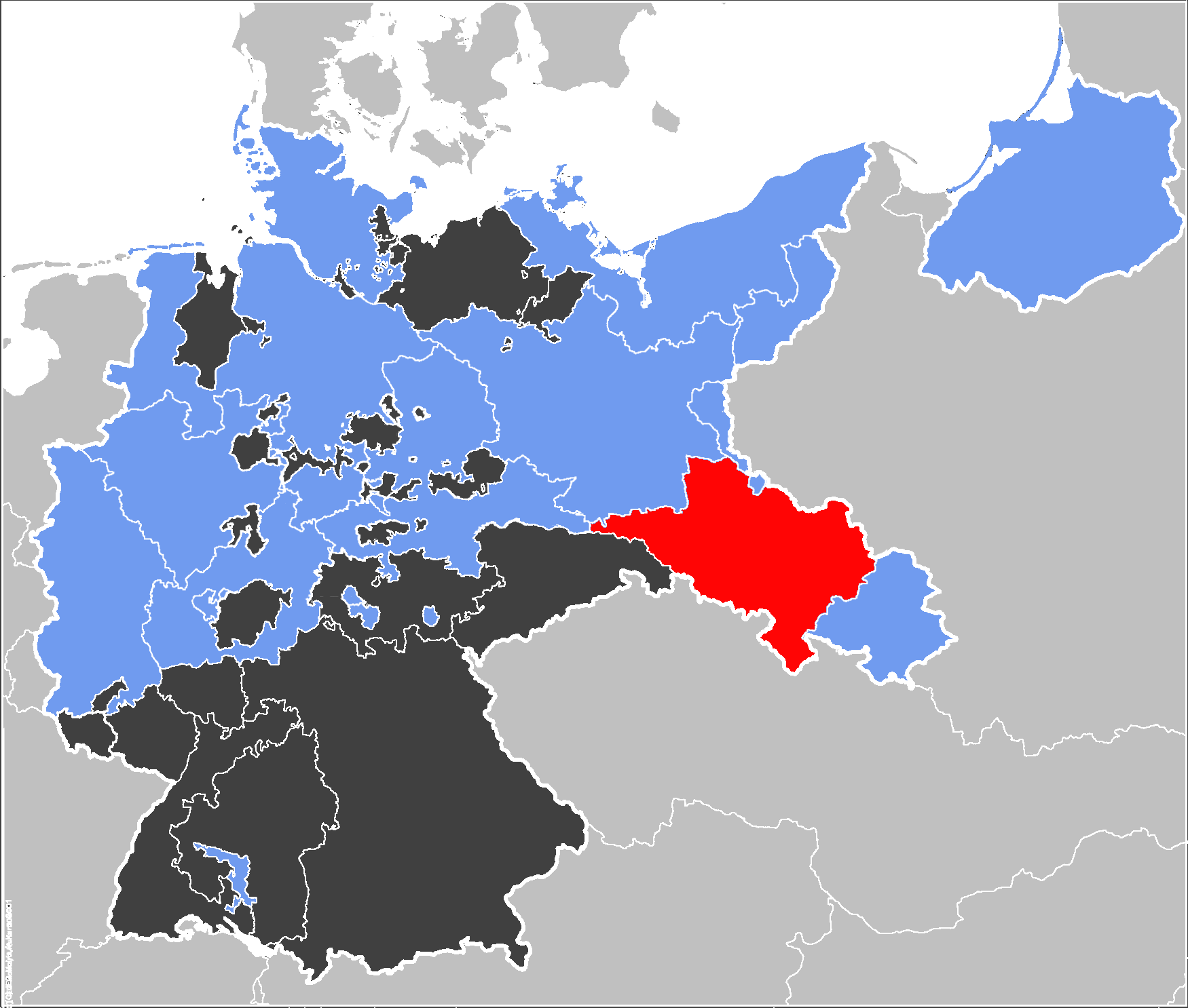
| current | 22:19, 29 December 2006 | | 1,750 × 1,486 (140 KB) | commons>Electionworld | {{ew|en|52 Pickup}} == Summary == The Prussian {{link|Province of Lower Silesia}} (red}, within the {{link|Kingdom of Prussia}} (blue). Other members of the {{link|German Confederation}} shown in black. ==Source== Map data of the IEG-Maps project by Andr |
File usage
There are no pages that use this file.