File:Manihiki Aerial.jpg
Jump to navigation
Jump to search

Size of this preview: 590 × 599 pixels. Other resolutions: 236 × 240 pixels | 472 × 480 pixels | 808 × 821 pixels.
Original file (808 × 821 pixels, file size: 210 KB, MIME type: image/jpeg)
File history
Click on a date/time to view the file as it appeared at that time.
| Date/Time | Thumbnail | Dimensions | User | Comment | |
|---|---|---|---|---|---|
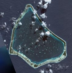
| current | 07:13, 23 June 2007 | | 808 × 821 (210 KB) | commons>Aotearoa | Satellite Image of Manihiki, Cook Islands. ==Licensing== {{PD-USGov-NASA}} |
File usage
There are no pages that use this file.