File:MGRSgridOriginSchemeAA.png
Jump to navigation
Jump to search

Size of this preview: 800 × 553 pixels. Other resolutions: 320 × 221 pixels | 640 × 442 pixels | 1,024 × 707 pixels | 1,280 × 884 pixels | 1,895 × 1,309 pixels.
Original file (1,895 × 1,309 pixels, file size: 461 KB, MIME type: image/png)
File history
Click on a date/time to view the file as it appeared at that time.
| Date/Time | Thumbnail | Dimensions | User | Comment | |
|---|---|---|---|---|---|
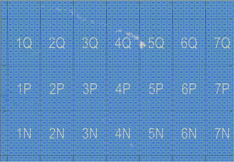
| current | 14:49, 20 November 2007 | | 1,895 × 1,309 (461 KB) | commons>MikaelR | {{Information |Description= {{en|Map of the Military Grid Reference System (MGRS) around its origin in the Pacific, with the AA lettering scheme for the 100 km squares. This scheme is used for WGS 84 and some other modern geodetic datums, while the alter |
File usage
There are no pages that use this file.