File:MGRSgridNorthPole.png
Jump to navigation
Jump to search

Size of this preview: 800 × 595 pixels. Other resolutions: 320 × 238 pixels | 640 × 476 pixels | 1,024 × 761 pixels | 1,280 × 951 pixels | 1,846 × 1,372 pixels.
Original file (1,846 × 1,372 pixels, file size: 1.54 MB, MIME type: image/png)
File history
Click on a date/time to view the file as it appeared at that time.
| Date/Time | Thumbnail | Dimensions | User | Comment | |
|---|---|---|---|---|---|
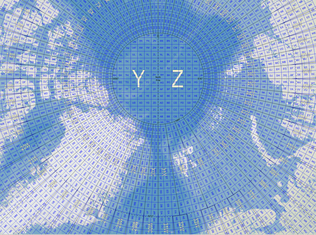
| current | 12:03, 21 November 2007 | | 1,846 × 1,372 (1.54 MB) | commons>MikaelR | {{Information |Description={{en|Map of the Military Grid Reference System (MGRS) around the North Pole, with the AA lettering scheme for the 100 km squares south of 84°N.}} |Source={{en|Mikael R made the MGRS grid in SpatialAce of Carmenta, with a backgr |
File usage
There are no pages that use this file.