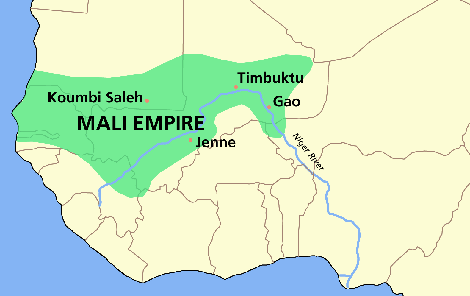
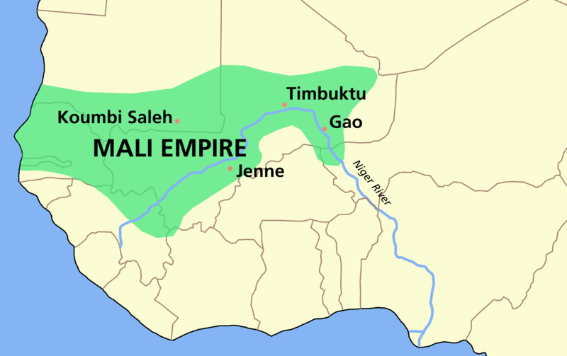
File:MALI empire map.PNG
Jump to navigation
Jump to search
Size of this preview: 800 × 503 pixels. Other resolutions: 320 × 201 pixels | 640 × 403 pixels | 1,024 × 644 pixels | 1,580 × 994 pixels.
Original file (1,580 × 994 pixels, file size: 70 KB, MIME type: image/png)
File history
Click on a date/time to view the file as it appeared at that time.
| Date/Time | Thumbnail | Dimensions | User | Comment | |
|---|---|---|---|---|---|
| current | 09:33, 4 February 2006 | | 1,580 × 994 (70 KB) | commons>Roke~commonswiki | Map of the w:Mali Empire made by User:Astrokey44 in Corel Painter IX Category: Maps of Africa {{GFDL-self}} |
File usage
There are no pages that use this file.