File:M4 motorway map animated.gif
Jump to navigation
Jump to search

Size of this preview: 800 × 370 pixels. Other resolutions: 320 × 148 pixels | 1,000 × 462 pixels.
Original file (1,000 × 462 pixels, file size: 125 KB, MIME type: image/gif, looped, 5 frames, 13 s)
File history
Click on a date/time to view the file as it appeared at that time.
| Date/Time | Thumbnail | Dimensions | User | Comment | |
|---|---|---|---|---|---|
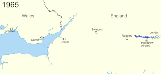
| current | 12:13, 26 March 2013 | | 1,000 × 462 (125 KB) | commons>Nilfanion | {{Information |Description=Animated timeline of the development of the w:M4 motorway, with frames showing the extent open in 1965, 1970, 1975, 1980 and 1996. Equirectangular map projection on WGS 84 datum, with N/S stretched 160% Geographic limi... |
File usage
There are no pages that use this file.