File:Luxor Peak.jpg
From WikiProjectMed
Jump to navigation
Jump to search
Size of this preview: 800 × 392 pixels. Other resolutions: 320 × 157 pixels | 640 × 314 pixels | 1,024 × 502 pixels | 1,280 × 628 pixels | 2,728 × 1,338 pixels.
Original file (2,728 × 1,338 pixels, file size: 927 KB, MIME type: image/jpeg)
This file is from a shared repository and may be used by other projects. The description on its file description page there is shown below.
Summary
DescriptionLuxor Peak.jpg |
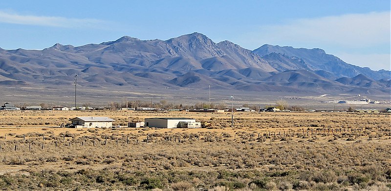
English: Northwest aspect of Luxor Peak centered, with Kumiva Peak in the distance to the right. Selenite Range, Nevada. |
Date | |
Source | https://www.flickr.com/photos/patrick_nouhailler/8691257577/ |
Author | Patrick Nouhailler |
Camera location | 40° 40′ 10.8″ N, 119° 22′ 00.6″ W | View this and other nearby images on: OpenStreetMap | 40.669667; -119.366833 |
---|
Licensing
This file is licensed under the Creative Commons Attribution-Share Alike 2.0 Generic license.
- You are free:
- to share – to copy, distribute and transmit the work
- to remix – to adapt the work
- Under the following conditions:
- attribution – You must give appropriate credit, provide a link to the license, and indicate if changes were made. You may do so in any reasonable manner, but not in any way that suggests the licensor endorses you or your use.
- share alike – If you remix, transform, or build upon the material, you must distribute your contributions under the same or compatible license as the original.
This image was originally posted to Flickr by Nouhailler at https://flickr.com/photos/7737054@N07/8691257577. It was reviewed on 28 August 2022 by FlickreviewR 2 and was confirmed to be licensed under the terms of the cc-by-sa-2.0. |
28 August 2022
Items portrayed in this file
depicts
some value
3 April 2013
40°40'10.801"N, 119°22'0.599"W
0.004 second
10
55 millimetre
100
image/jpeg
File history
Click on a date/time to view the file as it appeared at that time.
Date/Time | Thumbnail | Dimensions | User | Comment | |
---|---|---|---|---|---|
current | 00:37, 28 August 2022 | 2,728 × 1,338 (927 KB) | commons>Ron Clausen | crop, exposure |
File usage
There are no pages that use this file.
Metadata
This file contains additional information, probably added from the digital camera or scanner used to create or digitize it.
If the file has been modified from its original state, some details may not fully reflect the modified file.
Camera manufacturer | Canon |
---|---|
Camera model | Canon EOS 1100D |
Exposure time | 1/250 sec (0.004) |
F Number | f/10 |
ISO speed rating | 100 |
Date and time of data generation | 17:04, 3 April 2013 |
Lens focal length | 55 mm |
Latitude | 40° 40′ 10.8″ N |
Longitude | 119° 22′ 0.6″ W |
Altitude | 1,213.227 meters above sea level |
Image title | black rock desert - high rock canyon emigrant trails |
Location depicted | Great Boiling Spring |
Short title | black rock desert - high rock canyon emigrant trails |
Orientation | Normal |
Horizontal resolution | 72 dpi |
Vertical resolution | 72 dpi |
Software used | Windows Photo Editor 10.0.10011.16384 |
File change date and time | 17:29, 27 August 2022 |
Exposure Program | Landscape mode (for landscape photos with the background in focus) |
Exif version | 2.3 |
Date and time of digitizing | 17:04, 3 April 2013 |
APEX shutter speed | 8 |
APEX aperture | 6.625 |
APEX exposure bias | 0 |
Metering mode | Pattern |
Flash | Flash did not fire, compulsory flash suppression |
DateTime subseconds | 23 |
DateTimeOriginal subseconds | 23 |
DateTimeDigitized subseconds | 23 |
Supported Flashpix version | 1 |
Color space | sRGB |
Focal plane X resolution | 4,720.4418604651 |
Focal plane Y resolution | 4,786.5546875 |
Focal plane resolution unit | inches |
Custom image processing | Normal process |
Exposure mode | Auto exposure |
White balance | Auto white balance |
Scene capture type | Standard |
GPS time (atomic clock) | 00:04 |
Geodetic survey data used | WGS-84 |
GPS date | 4 April 2013 |
GPS tag version | 2.2.0.0 |
IIM version | 2 |
Keywords |
|
Country shown | …tats-Unis |
Sublocation of city shown | Great Boiling Spring |
Province or state shown | Nevada |
Retrieved from "https://mdwiki.org/wiki/File:Luxor_Peak.jpg"