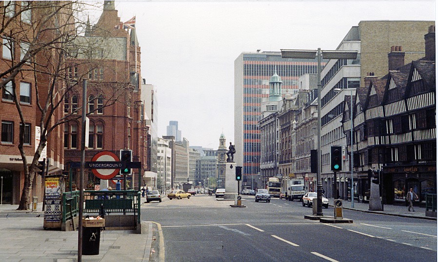
File:London High Holborn geograph-3083817-by-Ben-Brooksbank.jpg
Jump to navigation
Jump to search
Size of this preview: 800 × 480 pixels. Other resolutions: 320 × 192 pixels | 898 × 539 pixels.
Original file (898 × 539 pixels, file size: 194 KB, MIME type: image/jpeg)
File history
Click on a date/time to view the file as it appeared at that time.
| Date/Time | Thumbnail | Dimensions | User | Comment | |
|---|---|---|---|---|---|
| current | 18:42, 17 August 2012 | | 898 × 539 (194 KB) | commons>Chevin | == {{int:filedesc}} == {{Information |Description={{en|1='''Eastward along High Holborn at corner of Grays Inn Road.'''<br/> View from the eastern exit of Chancery Lane Underground station. Grays Inn Road is on the left, Staple Inn (dating from 1585) o... |
File usage
There are no pages that use this file.