File:Lockyer Creek Railway Bridge (Clarendon) (2008) 01.jpg
Jump to navigation
Jump to search

Size of this preview: 800 × 533 pixels. Other resolutions: 320 × 213 pixels | 640 × 426 pixels | 1,000 × 666 pixels.
Original file (1,000 × 666 pixels, file size: 166 KB, MIME type: image/jpeg)
_(2008)_01.jpg)
Summary
| Description |
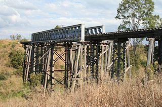
English: Lockyer Creek Railway Bridge (Clarendon) (2008) |
| Date | |
| Source | State of Queensland: Queensland Heritage Register: Lockyer Creek Railway Bridge (Clarendon) (2008) |
| Author | Heritage branch staff |
| Camera location | | View this and other nearby images on: OpenStreetMap |
|---|
_(2008)_01.jpg¶ms=-27.419900_N_0152.530500_E_globe:Earth_type:camera__&language=en)
Licensing
This file is licensed under the Creative Commons Attribution 3.0 Unported license.
- You are free:
- to share – to copy, distribute and transmit the work
- to remix – to adapt the work
- Under the following conditions:
- attribution – You must give appropriate credit, provide a link to the license, and indicate if changes were made. You may do so in any reasonable manner, but not in any way that suggests the licensor endorses you or your use.
File history
Click on a date/time to view the file as it appeared at that time.
| Date/Time | Thumbnail | Dimensions | User | Comment | |
|---|---|---|---|---|---|
| current | 08:20, 14 November 2016 | | 1,000 × 666 (166 KB) | commons>Kerry Raymond | User created page with UploadWizard |
File usage
There are no pages that use this file.
_(2008)_01.jpg)