File:Location map Peninsula Malaysia.png

Original file (539 × 656 pixels, file size: 449 KB, MIME type: image/png)

|
This locator map image could be re-created using vector graphics as an SVG file. This has several advantages; see Commons:Media for cleanup for more information. If an SVG form of this image is available, please upload it and afterwards replace this template with
{{vector version available|new image name}}.
It is recommended to name the SVG file “Location map Peninsula Malaysia.svg”—then the template Vector version available (or Vva) does not need the new image name parameter. |
Summary
| Description |
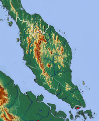
Relief map of Peninsula Malaysia Geographic limits of the map:
|
| Date | |
| Source | http://www.maps-for-free.com/ |
| Author | Modified by Dr. Blofeld |
| Permission (Reusing this file) |
http://www.maps-for-free.com/html/about.html |
Licensing
This screenshot either does not contain copyright-eligible parts or visuals of copyrighted software, or the author has released it under a free license (which should be indicated beneath this notice), and as such follows the licensing guidelines for screenshots of Wikimedia Commons. You may use it freely according to its particular license. Free software license:

|
This work is free software; you can redistribute it and/or modify it under the terms of the GNU General Public License as published by the Free Software Foundation; either version 2 of the License, or any later version. This work is distributed in the hope that it will be useful, but without any warranty; without even the implied warranty of merchantability or fitness for a particular purpose. See version 2 and version 3 of the GNU General Public License for more details. |
Note: if the screenshot shows any work that is not a direct result of the program code itself, such as a text or graphics that are not part of the program, the license for that work must be indicated separately.
Licensing
- You are free:
- to share – to copy, distribute and transmit the work
- to remix – to adapt the work
- Under the following conditions:
- attribution – You must give appropriate credit, provide a link to the license, and indicate if changes were made. You may do so in any reasonable manner, but not in any way that suggests the licensor endorses you or your use.
File history
Click on a date/time to view the file as it appeared at that time.
| Date/Time | Thumbnail | Dimensions | User | Comment | |
|---|---|---|---|---|---|
| current | 11:58, 6 March 2011 | | 539 × 656 (449 KB) | commons>Blofeld Dr. | {{Information |Description ={{en|1=y}} |Source =y |Author =y |Date =y |Permission = |other_versions = }} |
File usage
The following page uses this file: