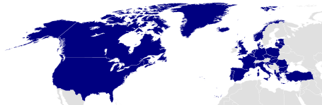
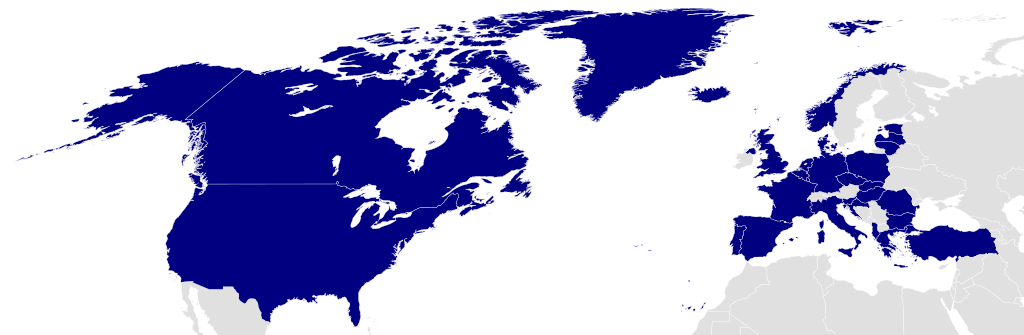
File:Location NATO 2009 blue.svg
Jump to navigation
Jump to search

Size of this PNG preview of this SVG file: 455 × 149 pixels. Other resolutions: 320 × 105 pixels | 640 × 210 pixels | 1,024 × 335 pixels | 1,280 × 419 pixels | 2,560 × 838 pixels.
Original file (SVG file, nominally 455 × 149 pixels, file size: 1.45 MB)
File history
Click on a date/time to view the file as it appeared at that time.
| Date/Time | Thumbnail | Dimensions | User | Comment | |
|---|---|---|---|---|---|
| current | 10:39, 15 August 2022 | 455 × 149 (1.45 MB) | commons>EmmaCoop | Reverted to version as of 05:51, 1 March 2015 (UTC); the map represents NATO as it existed in 2009 |
File usage
There are no pages that use this file.