File:LocationNSAmUNGeoscheme.png
Jump to navigation
Jump to search

Size of this preview: 600 × 600 pixels. Other resolutions: 240 × 240 pixels | 480 × 480 pixels.
Original file (800 × 800 pixels, file size: 22 KB, MIME type: image/png)
File history
Click on a date/time to view the file as it appeared at that time.
| Date/Time | Thumbnail | Dimensions | User | Comment | |
|---|---|---|---|---|---|
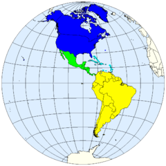
| current | 19:02, 12 October 2007 | | 800 × 800 (22 KB) | commons>Spacepotato | == Summary == {{Information |Description=United Nations geoscheme for the Americas. |Source=prepared from public domain maps created by w:en:User:E Pluribus Anthony. |Date=October 12, 2007. |Author= Spacepotato }} ==Legend== {{leg |
File usage
There are no pages that use this file.