File:LithuaniaPhysicalMap-lt.png
Jump to navigation
Jump to search

Size of this preview: 800 × 566 pixels. Other resolutions: 320 × 226 pixels | 640 × 453 pixels | 1,024 × 724 pixels | 1,280 × 905 pixels | 2,360 × 1,669 pixels.
Original file (2,360 × 1,669 pixels, file size: 2.09 MB, MIME type: image/png)
File history
Click on a date/time to view the file as it appeared at that time.
| Date/Time | Thumbnail | Dimensions | User | Comment | |
|---|---|---|---|---|---|
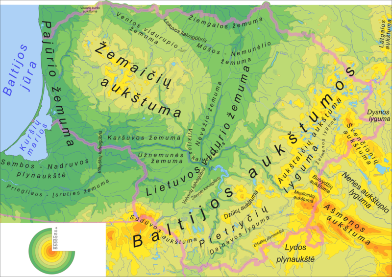
| current | 06:57, 2 February 2006 | | 2,360 × 1,669 (2.09 MB) | commons>Knutux | == Summary == Physical map of the Lithuania with lithuanian labels. Created from Image:LithuaniaPhysicalMap-lt.svg Category:Maps of Lithuania |
File usage
There are no pages that use this file.