File:Liberty - panoramio (1) (cropped).jpg
Jump to navigation
Jump to search

Size of this preview: 337 × 599 pixels. Other resolutions: 135 × 240 pixels | 270 × 480 pixels | 432 × 768 pixels | 1,134 × 2,016 pixels.
Original file (1,134 × 2,016 pixels, file size: 966 KB, MIME type: image/jpeg)
Summary
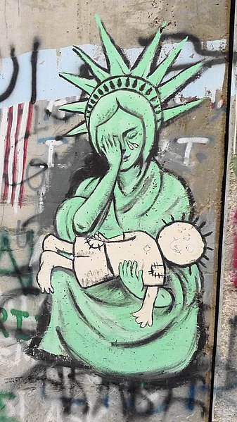
| Description | Liberty | ||
| Date | Taken on 19 November 2010 | ||
| Source | https://web.archive.org/web/20161017181430/http://www.panoramio.com/photo/43943448 | ||
| Author | Mujaddara | ||
| Permission (Reusing this file) |
This file is licensed under the Creative Commons Attribution-Share Alike 3.0 Unported license. Attribution: Mujaddara
|
||
| Other versions | |||
| Tags (from Panoramio photo page) | Bethlehem, grafiti, West Bank |
.jpg)
_(cropped).jpg)
| Camera location | | View this and other nearby images on: OpenStreetMap |
|---|
_(cropped).jpg¶ms=031.719360_N_0035.203613_E_globe:Earth_type:camera_source:Panoramio_&language=en)
File history
Click on a date/time to view the file as it appeared at that time.
| Date/Time | Thumbnail | Dimensions | User | Comment | |
|---|---|---|---|---|---|
| current | 08:20, 8 June 2020 | | 1,134 × 2,016 (966 KB) | commons>Onceinawhile | File:Liberty - panoramio (1).jpg cropped 70 % horizontally, 20 % vertically using CropTool with precise mode. |
.jpg)
File usage
There are no pages that use this file.
_(cropped).jpg)