File:Laurie island map-en.svg
Jump to navigation
Jump to search

Size of this PNG preview of this SVG file: 800 × 420 pixels. Other resolutions: 320 × 168 pixels | 640 × 336 pixels | 1,024 × 537 pixels | 1,280 × 672 pixels | 2,560 × 1,343 pixels | 867 × 455 pixels.
Original file (SVG file, nominally 867 × 455 pixels, file size: 133 KB)
File history
Click on a date/time to view the file as it appeared at that time.
| Date/Time | Thumbnail | Dimensions | User | Comment | |
|---|---|---|---|---|---|
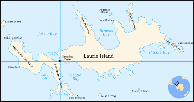
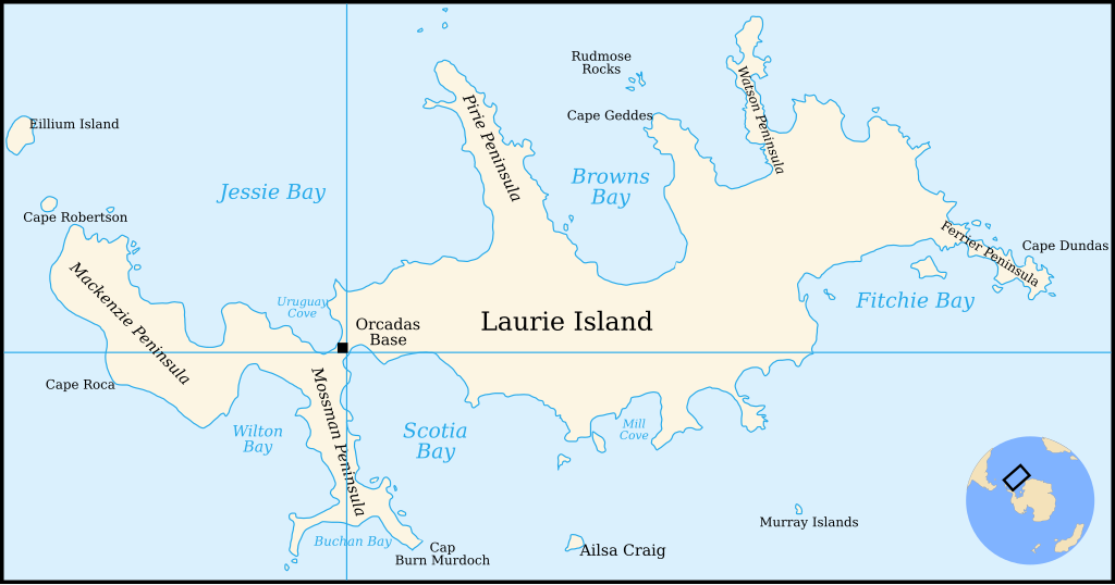
| current | 21:29, 4 January 2011 | | 867 × 455 (133 KB) | commons>4ing | == {{int:filedesc}} == {{Information |Description={{en|1=Map of Laurie Island, South Orkney Islands}} |Source=Translation of File:Laurie island map-fr.svg |Author=Original by Pinpin, translated to English by 4ing |Date=2 |
File usage
There are no pages that use this file.