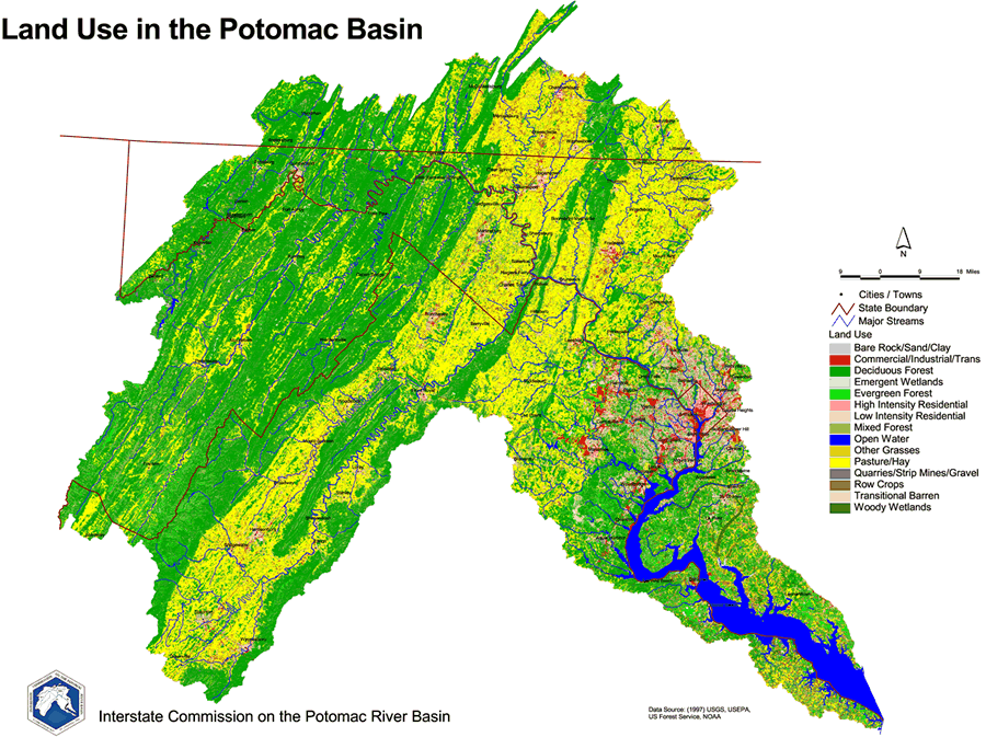
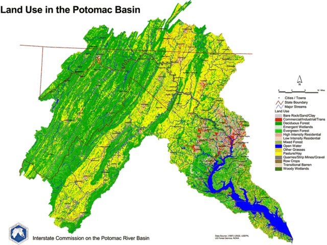
File:Land Use in the Potomac Basin.gif
Jump to navigation
Jump to search
Size of this preview: 800 × 598 pixels. Other resolutions: 320 × 239 pixels | 640 × 479 pixels | 900 × 673 pixels.
Original file (900 × 673 pixels, file size: 232 KB, MIME type: image/gif, 0.2 s)
File history
Click on a date/time to view the file as it appeared at that time.
| Date/Time | Thumbnail | Dimensions | User | Comment | |
|---|---|---|---|---|---|
| current | 19:44, 20 March 2006 | | 900 × 673 (232 KB) | commons>West Virginian | 1997 Land Use Map of the Potomac River Basin provided to the public domain by the U.S. Department of the Interior and the U.S. Geological Survey. {{USGS}} |
File usage
There are no pages that use this file.