File:LandForm displays landmarks and other indicators during helicopter flight at Yuma Proving Ground..JPG
Jump to navigation
Jump to search
No higher resolution available.
LandForm_displays_landmarks_and_other_indicators_during_helicopter_flight_at_Yuma_Proving_Ground..JPG (720 × 480 pixels, file size: 339 KB, MIME type: image/jpeg)
Summary
| Description |
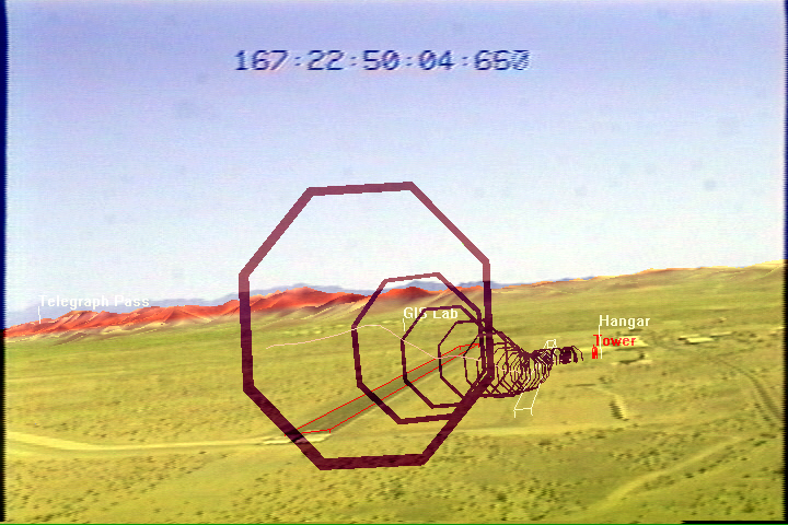
English: LandForm video with map overlays showing landmarks and other indicators during helicopter flight at Yuma Proving Ground. Note markers for the hangar and tower at center right. |
| Date | |
| Source | Own work |
| Author | Winged1der |
Licensing
I, the copyright holder of this work, hereby publish it under the following license:
This file is licensed under the Creative Commons Attribution-Share Alike 3.0 Unported license.
- You are free:
- to share – to copy, distribute and transmit the work
- to remix – to adapt the work
- Under the following conditions:
- attribution – You must give appropriate credit, provide a link to the license, and indicate if changes were made. You may do so in any reasonable manner, but not in any way that suggests the licensor endorses you or your use.
- share alike – If you remix, transform, or build upon the material, you must distribute your contributions under the same or compatible license as the original.
File history
Click on a date/time to view the file as it appeared at that time.
| Date/Time | Thumbnail | Dimensions | User | Comment | |
|---|---|---|---|---|---|
| current | 21:19, 7 April 2014 | | 720 × 480 (339 KB) | commons>Winged1der | User created page with UploadWizard |
File usage
There are no pages that use this file.