File:Lakechad map.png
Jump to navigation
Jump to search
No higher resolution available.
Lakechad_map.png (588 × 362 pixels, file size: 38 KB, MIME type: image/png)
File history
Click on a date/time to view the file as it appeared at that time.
| Date/Time | Thumbnail | Dimensions | User | Comment | |
|---|---|---|---|---|---|
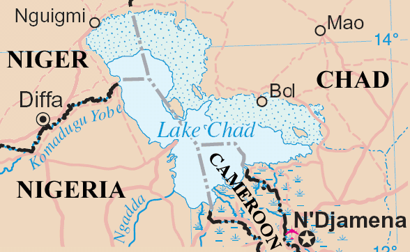
| current | 16:20, 23 May 2006 | | 588 × 362 (38 KB) | commons>Amcaja | Lake Chad and surrounding area Map adapted from http://www.un.org/Depts/Cartographic/map/profile/niger.pdf {{UN map}} Category:Maps Category:Maps of Cameroon |
File usage
There are no pages that use this file.