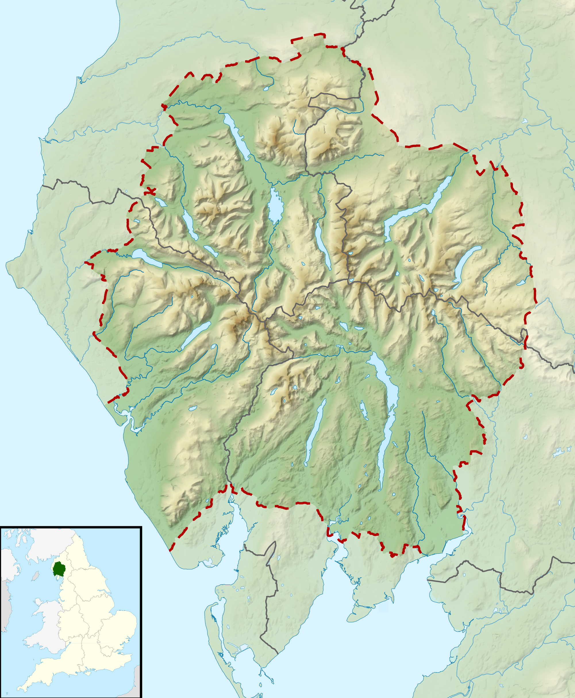
File:Lake District National Park UK relief location map.png
Jump to navigation
Jump to search
Size of this preview: 494 × 600 pixels. Other resolutions: 198 × 240 pixels | 395 × 480 pixels | 632 × 768 pixels | 843 × 1,024 pixels | 2,001 × 2,430 pixels.
Original file (2,001 × 2,430 pixels, file size: 3.62 MB, MIME type: image/png)
File history
Click on a date/time to view the file as it appeared at that time.
| Date/Time | Thumbnail | Dimensions | User | Comment | |
|---|---|---|---|---|---|
| current | 10:51, 17 March 2012 | | 2,001 × 2,430 (3.62 MB) | commons>Nilfanion | {{Information |Description=Relief map of the Lake District National Park, UK Equirectangular map projection on WGS 84 datum, with N/S stretched 170% Geographic limits: *West: 3.65W *East: 2.60W *North: 54.80N *South: 54.05N |Sourc... |
File usage
There are no pages that use this file.