File:Kysten av Romsdal og Nordmøre 8.01767E 63.02936N.png
Jump to navigation
Jump to search

Size of this preview: 725 × 600 pixels. Other resolutions: 290 × 240 pixels | 580 × 480 pixels | 928 × 768 pixels | 1,130 × 935 pixels.
Original file (1,130 × 935 pixels, file size: 1.67 MB, MIME type: image/png)
File history
Click on a date/time to view the file as it appeared at that time.
| Date/Time | Thumbnail | Dimensions | User | Comment | |
|---|---|---|---|---|---|
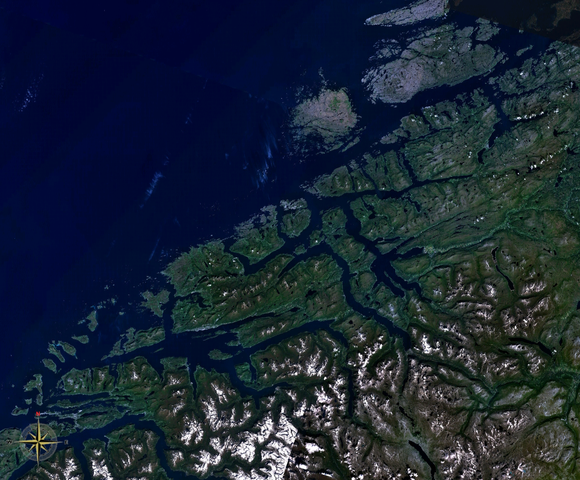
| current | 13:35, 3 April 2008 | | 1,130 × 935 (1.67 MB) | commons>Ranveig | {{Information |Description= {{en|Satellite imagery of the fjord system of Nordmøre (top) and Romsdalsfjorden (bottom). The islands that can be seen fully are Hitra (larger, northern) and Smøla.}} {{nn|Satellittbilete av fjordsystemet på Sunnmøre, og R |
File usage
There are no pages that use this file.