File:Kurdisches Siedlungsgebiet.PNG
Jump to navigation
Jump to search
No higher resolution available.
Kurdisches_Siedlungsgebiet.PNG (634 × 324 pixels, file size: 25 KB, MIME type: image/png)
File history
Click on a date/time to view the file as it appeared at that time.
| Date/Time | Thumbnail | Dimensions | User | Comment | |
|---|---|---|---|---|---|
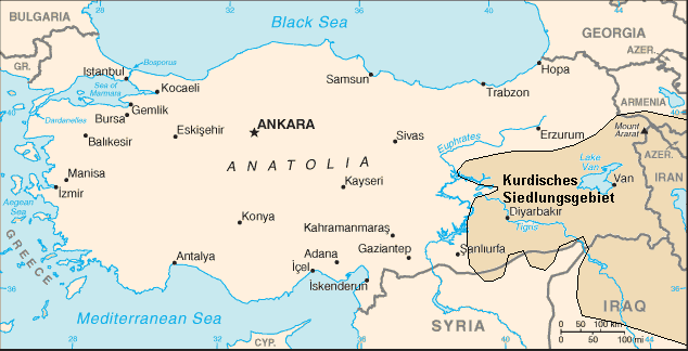
| current | 20:59, 23 February 2008 | | 634 × 324 (25 KB) | commons>Cocoloi | {{Information |Description={{de|Kurdisches Siedlungsgebiet. Ursprungskarte aus CIA/World factbook plus Modifikationen nach Informationen zur politischen Bildung. Urspungskarte = de:public domain Modifikationen = de:GNU-FDL}} |Source=Transferred |
File usage
There are no pages that use this file.