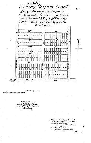
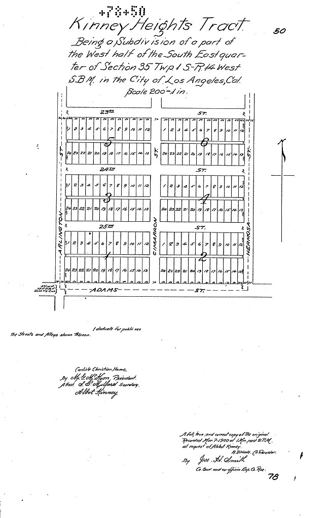
File:Kinney Heights tract map.jpg
Jump to navigation
Jump to search

Size of this preview: 379 × 599 pixels. Other resolutions: 152 × 240 pixels | 303 × 480 pixels | 485 × 768 pixels | 647 × 1,024 pixels | 1,782 × 2,818 pixels.
Original file (1,782 × 2,818 pixels, file size: 587 KB, MIME type: image/jpeg)
File history
Click on a date/time to view the file as it appeared at that time.
| Date/Time | Thumbnail | Dimensions | User | Comment | |
|---|---|---|---|---|---|
| current | 01:55, 5 November 2023 | | 1,782 × 2,818 (587 KB) | commons>Jengod | Uploaded a work by L.A. County from https://pw.lacounty.gov/sur/nas/landrecords/misc/MR078/MR078-050.pdf with UploadWizard |
File usage
There are no pages that use this file.