File:Kingdom of Prussia 1714.svg
Jump to navigation
Jump to search

Size of this PNG preview of this SVG file: 450 × 456 pixels. Other resolutions: 237 × 240 pixels | 474 × 480 pixels | 758 × 768 pixels | 1,011 × 1,024 pixels | 2,021 × 2,048 pixels.
Original file (SVG file, nominally 450 × 456 pixels, file size: 893 KB)
File history
Click on a date/time to view the file as it appeared at that time.
| Date/Time | Thumbnail | Dimensions | User | Comment | |
|---|---|---|---|---|---|
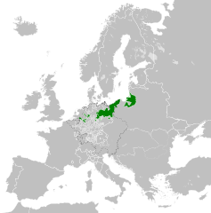
| current | 19:51, 23 April 2016 | | 450 × 456 (893 KB) | commons>Alphathon | {{Information |Description={{en|A map of the Kingdom of Prussia in Europe circa 1714. This map also includes a border for the Holy Roman Empire (HRE).}}{{de|Eine Landkarte Preußens c. 1714.}} |Source= {{Derived from|Blank_map... |
File usage
There are no pages that use this file.