File:King George Island map-en.svg
Jump to navigation
Jump to search

Size of this PNG preview of this SVG file: 661 × 403 pixels. Other resolutions: 320 × 195 pixels | 640 × 390 pixels | 1,024 × 624 pixels | 1,280 × 780 pixels | 2,560 × 1,561 pixels.
Original file (SVG file, nominally 661 × 403 pixels, file size: 209 KB)
File history
Click on a date/time to view the file as it appeared at that time.
| Date/Time | Thumbnail | Dimensions | User | Comment | |
|---|---|---|---|---|---|
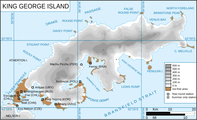
| current | 12:22, 14 June 2010 | | 661 × 403 (209 KB) | commons>Treehill | {{Information |Description=King George Island map. Detailed. Relief. Research Stations. {{fr|Carte de l'île du Roi-George. Relief et stations de recherches}} {{en|King George Island map. Detailed. Relief. Research Stations.}} |Source=*[[:File:Kgeorge_map |
File usage
There are no pages that use this file.