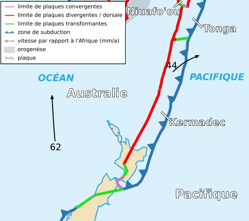
File:Kermadec Plate map-fr.png
Jump to navigation
Jump to search
No higher resolution available.
Kermadec_Plate_map-fr.png (497 × 441 pixels, file size: 150 KB, MIME type: image/png)
File history
Click on a date/time to view the file as it appeared at that time.
| Date/Time | Thumbnail | Dimensions | User | Comment | |
|---|---|---|---|---|---|
| current | 22:59, 18 November 2006 | | 497 × 441 (150 KB) | commons>Rémih | {{Information |Description={{fr|Carte de la plaque des Kermadec}}{{en|Map of the Kermadec Plate}} |Source=Cropped version by myself of Image:Tectonic_plates_boundaries_detailed-fr.svg created by Sting under CC-BY-SA |Date=18/11/2006 |A |
File usage
There are no pages that use this file.