File:KentuckyRiver watershed.png
Jump to navigation
Jump to search
No higher resolution available.
KentuckyRiver_watershed.png (300 × 221 pixels, file size: 63 KB, MIME type: image/png)
File history
Click on a date/time to view the file as it appeared at that time.
| Date/Time | Thumbnail | Dimensions | User | Comment | |
|---|---|---|---|---|---|
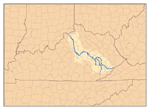
| current | 19:17, 1 February 2007 | | 300 × 221 (63 KB) | commons>Pfly | {{Information |Description=This is a map of the Kentucky River watershed, showing the North Fork, Middle Fork, and South Fork tributaries. I, Pfly, made it, based on USGS data. |Source=Own work. |Date= |
File usage
There are no pages that use this file.