File:Karte Geschäftsgebiete deutscher Sparkassen und Sparkassenverbände.png
Jump to navigation
Jump to search
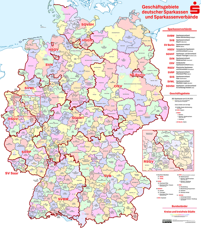
Size of this preview: 529 × 600 pixels. Other resolutions: 212 × 240 pixels | 423 × 480 pixels | 678 × 768 pixels | 903 × 1,024 pixels | 1,807 × 2,048 pixels | 6,000 × 6,800 pixels.
Original file (6,000 × 6,800 pixels, file size: 9.39 MB, MIME type: image/png)
Summary
| Description |
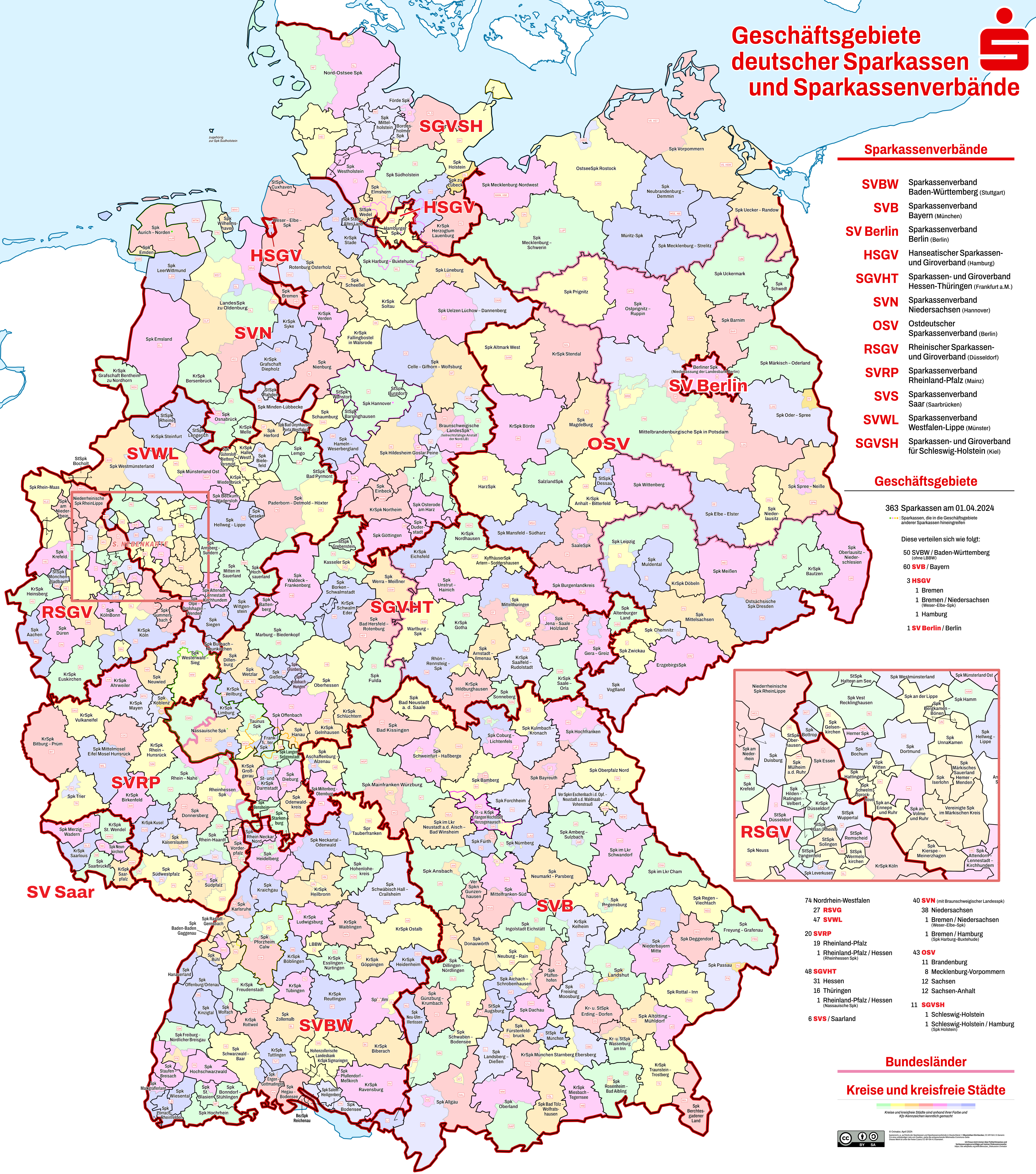
Deutsch: Die Karte zeigt die einzelnen Geschäftsgebiete der Sparkassen und Sparkassenverbände in Deutschland. |
| Date | |
| Source |
Own work, using
Anmerkung des ursprünglichen Urhebers Chumwa: Der Inhalt der Karte ist aus unterschiedlichen Quellen zusammengestellt, v.a. aus Angaben in den Geschäftsberichten diverser Sparkassenverbände und Sparkassen, aber auch aus anderen Quellen. Sie enthält an manchen Stellen auch reine Vermutungen, da die Information der Sparkassen über ihre Geschäftsgebiete sehr dürftig ist, so dass ich für jeden Korrekturhinweis höchst dankbar bin! |
| Author | Ovinator |
| Permission (Reusing this file) |
Deutsch: Wichtiger Hinweise bzgl. „© GeoBasis-DE / BKG 2013-Daten“ gem. Verordnung zur Festlegung der Nutzungsbestimmungen für die Bereitstellung von Geodaten des Bundes vom 19. März 2013 (BGBl. I S. 547) (GEoNutzV). Die Rechstfolgen der GeoNutzV sind unklar, besonders bzgl. abgeleiteter Dateien, inbes. bei Einarbeitung anders lizenzierter Daten. Es dürfte daher ratsam sein, die BKG-Quellenangaben immer auch in allen abgeleiteten Werken anzugeben. English: Important note for all data attributed © GeoBasis-DE / BKG 2013 according Verordnung zur Festlegung der Nutzungsbestimmungen für die Bereitstellung von Geodaten des Bundes vom 19. März 2013 (BGBl. I S. 547) (GEoNutzV). It's not clear what this act implies in terms of which licenses are applicable for derived works especially those where differently licensed data is incorporated. It may be best to keep the attribution to BKG-data in every file derived. |
| Other versions |
|

.png)

_location_map_current.svg)

|
Diese Karte bedarf einer Aktualisierung oder enthält Fehler? Melde das gerne auf meiner Diskussionsseite!
Auch Verbesserungsvorschläge, die die Gestaltung der Karte (Typografie, Farbgebung, etc.) betreffen, sind gerne gesehen.
|
Licensing
This file is licensed under the Creative Commons Attribution-Share Alike 4.0 International license.
- You are free:
- to share – to copy, distribute and transmit the work
- to remix – to adapt the work
- Under the following conditions:
- attribution – You must give appropriate credit, provide a link to the license, and indicate if changes were made. You may do so in any reasonable manner, but not in any way that suggests the licensor endorses you or your use.
- share alike – If you remix, transform, or build upon the material, you must distribute your contributions under the same or compatible license as the original.
File history
Click on a date/time to view the file as it appeared at that time.
| Date/Time | Thumbnail | Dimensions | User | Comment | |
|---|---|---|---|---|---|
| current | 01:03, 1 April 2024 | | 6,000 × 6,800 (9.39 MB) | commons>Ovinator | Verbesserungen HH, Farbschemaänderung |
File usage
There are no pages that use this file.