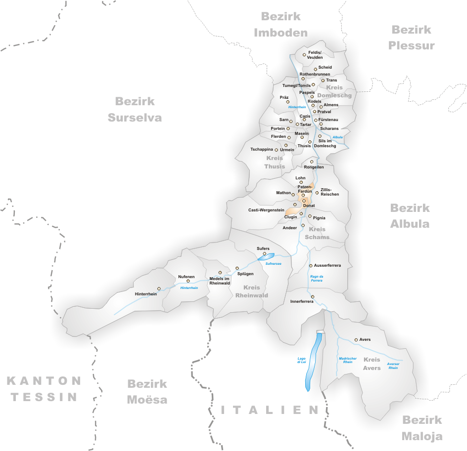
File:Karte Gemeinden des Bezirks Hinterrhein 2002.png
Jump to navigation
Jump to search
Size of this preview: 620 × 600 pixels. Other resolutions: 248 × 240 pixels | 496 × 480 pixels | 944 × 913 pixels.
Original file (944 × 913 pixels, file size: 232 KB, MIME type: image/png)
File history
Click on a date/time to view the file as it appeared at that time.
| Date/Time | Thumbnail | Dimensions | User | Comment | |
|---|---|---|---|---|---|
| current | 14:13, 4 January 2006 | | 944 × 913 (232 KB) | commons>Tschubby | Municipalities in the district of Hinterrhein until 2002 Map drawn by Tschubby Hinterrhein 2002 {{GFDL}} |
File usage
There are no pages that use this file.