File:Karte Eroberung Konstantinopel 1453.png
Jump to navigation
Jump to search

Size of this preview: 750 × 600 pixels. Other resolutions: 300 × 240 pixels | 600 × 480 pixels | 960 × 768 pixels | 1,280 × 1,024 pixels | 2,500 × 2,000 pixels.
Original file (2,500 × 2,000 pixels, file size: 1.18 MB, MIME type: image/png)
File history
Click on a date/time to view the file as it appeared at that time.
| Date/Time | Thumbnail | Dimensions | User | Comment | |
|---|---|---|---|---|---|
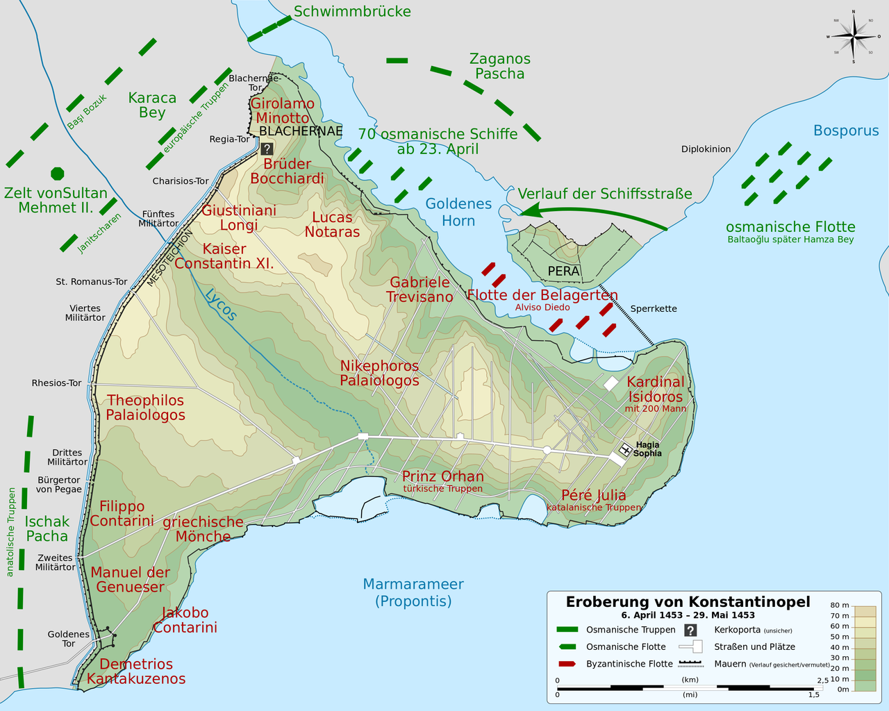
| current | 08:39, 13 April 2013 | | 2,500 × 2,000 (1.18 MB) | commons>Lokiseinchef | == {{int:filedesc}} == {{Information |Description={{Multilingual description |en= Map of the Ottoman and Byzantine forces during the siege of Constantinople, from 6 April 1453 to 29 May 1453. French version. |fr= Carte de... |
File usage
There are no pages that use this file.