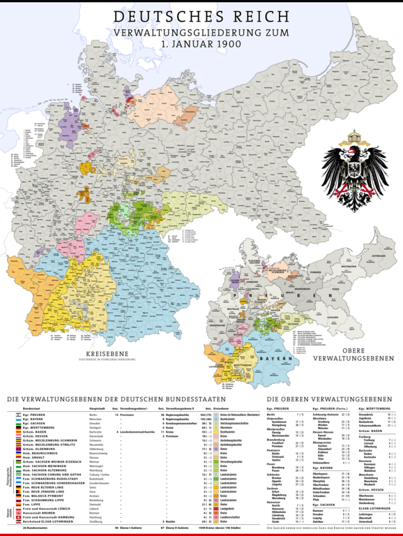
File:Karte Deutsches Reich, Verwaltungsgliederung 1900-01-01.png
Jump to navigation
Jump to search

Size of this preview: 452 × 600 pixels. Other resolutions: 181 × 240 pixels | 361 × 480 pixels | 578 × 768 pixels | 771 × 1,024 pixels | 1,543 × 2,048 pixels | 5,013 × 6,654 pixels.
Original file (5,013 × 6,654 pixels, file size: 6 MB, MIME type: image/png)
File history
Click on a date/time to view the file as it appeared at that time.
| Date/Time | Thumbnail | Dimensions | User | Comment | |
|---|---|---|---|---|---|
| current | 15:02, 8 March 2024 | | 5,013 × 6,654 (6 MB) | commons>Pilum2211 | Previous Pload error (?) |
File usage
There are no pages that use this file.