File:Karte Altausseer See.png
Jump to navigation
Jump to search

Size of this preview: 674 × 599 pixels. Other resolutions: 270 × 240 pixels | 540 × 480 pixels | 864 × 768 pixels | 1,128 × 1,003 pixels.
Original file (1,128 × 1,003 pixels, file size: 1.45 MB, MIME type: image/png)
File history
Click on a date/time to view the file as it appeared at that time.
| Date/Time | Thumbnail | Dimensions | User | Comment | |
|---|---|---|---|---|---|
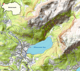
| current | 19:03, 11 January 2021 | | 1,128 × 1,003 (1.45 MB) | commons>NordNordWest | == {{int:filedesc}} == {{Information |description={{de|1=Karte des Altausseer Sees in der Steiermark}} |source={{Own using}} * Kartendaten: © [https://www.openstreetmap.org/copyright OpenStreetMap]-Mitwirkende, [http://viewfinderpanoramas.org SRTM], Kartendarstellung: © [https://opentopomap.org OpenTopoMap] ([https://creativecommons.org/licenses/by-sa/3.0/ CC-BY-SA]) |date=2021-01-11 |author={{U|NordNordWest}} |permission= |other_versions= {{Kartenwerkstatt}} == {{int:license-header}} == {{... |
File usage
There are no pages that use this file.