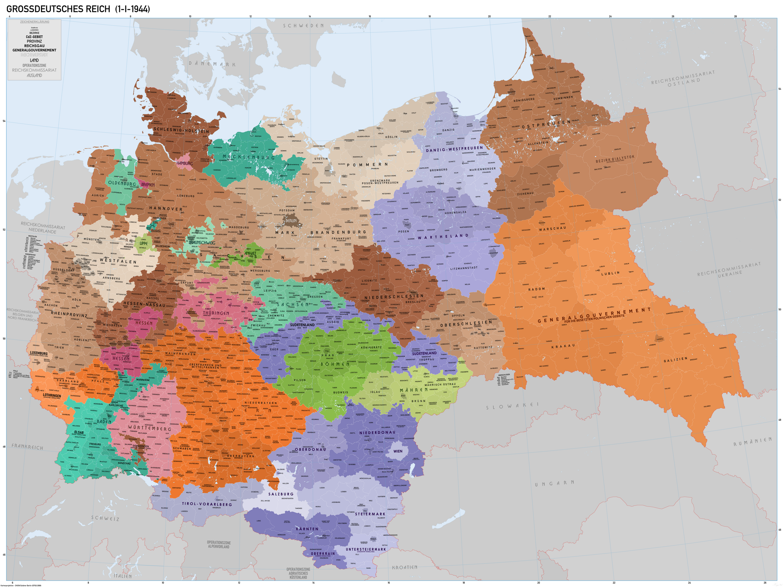
File:KarteDesGrossdeutschenReichesJan1944.png
Jump to navigation
Jump to search

Size of this preview: 800 × 600 pixels. Other resolutions: 320 × 240 pixels | 640 × 480 pixels | 1,024 × 768 pixels | 1,280 × 960 pixels | 2,560 × 1,920 pixels | 8,000 × 6,000 pixels.
Original file (8,000 × 6,000 pixels, file size: 11.59 MB, MIME type: image/png)
File history
Click on a date/time to view the file as it appeared at that time.
| Date/Time | Thumbnail | Dimensions | User | Comment | |
|---|---|---|---|---|---|
| current | 10:30, 17 October 2021 | | 8,000 × 6,000 (11.59 MB) | commons>XrysD | Incorporated typos KRUBIESZOW->HRUBIESZOW and CZORTZOW->CZORTKOW and removed duplicate of Gumpolds in Boh-Mar. Reverted Lublin district border changes, see https://commons.wikimedia.org/wiki/User_talk:Kamilhrub |
File usage
There are no pages that use this file.