File:Karnataka topo deu.png
Jump to navigation
Jump to search
Size of this preview: 499 × 599 pixels. Other resolutions: 200 × 240 pixels | 637 × 765 pixels.
Original file (637 × 765 pixels, file size: 893 KB, MIME type: image/png)
File history
Click on a date/time to view the file as it appeared at that time.
| Date/Time | Thumbnail | Dimensions | User | Comment | |
|---|---|---|---|---|---|
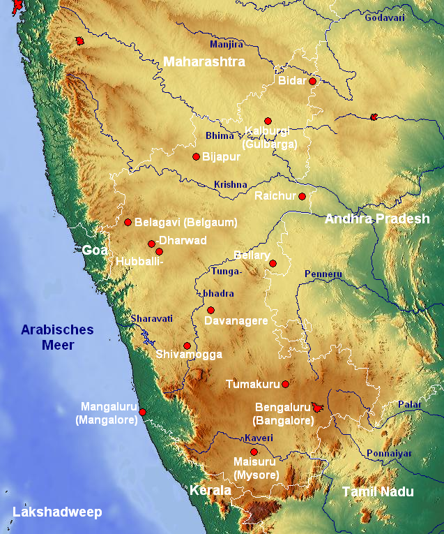
| current | 17:54, 26 February 2008 | | 637 × 765 (893 KB) | commons>Jungpionier | {{Information |Description=Topographische Karte von Karnataka (Indien) mit Städten und Flüssen |Source=[http://www.maps-for-free.com/ www.maps-for-free.com] |Date=26. Februar 2008 |Author= Jungpionier }} {{cc-by-sa-3.0}} [[Categor |
File usage
There are no pages that use this file.