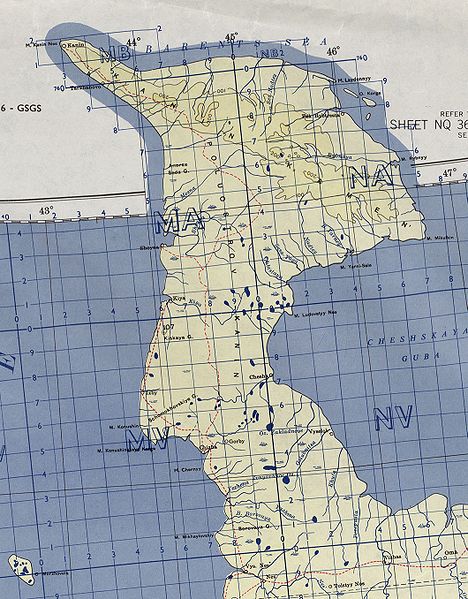
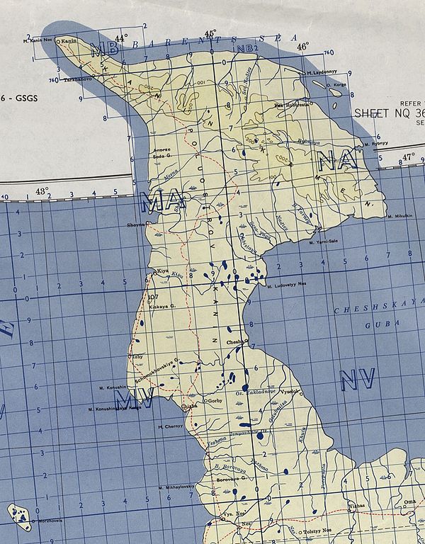
File:Kanin-txu-oclc-6654394-nq-36-38-6th-ed.jpg
Jump to navigation
Jump to search

Size of this preview: 468 × 599 pixels. Other resolutions: 187 × 240 pixels | 375 × 480 pixels | 600 × 768 pixels | 1,059 × 1,356 pixels.
Original file (1,059 × 1,356 pixels, file size: 1.19 MB, MIME type: image/jpeg)
File history
Click on a date/time to view the file as it appeared at that time.
| Date/Time | Thumbnail | Dimensions | User | Comment | |
|---|---|---|---|---|---|
| current | 14:44, 3 April 2010 | | 1,059 × 1,356 (1.19 MB) | commons>Ratzer | {{Information |Description={{en|1=map of Kanin peninsula, Russia}} |Source=http://www.lib.utexas.edu/maps/imw/txu-oclc-6654394-nq-36-38-6th-ed.jpg |Author=Army Map Service |Date=1956 |Permission= |other_versions= }} Category:Maps of Murmansk Oblast |
File usage
There are no pages that use this file.