File:Kaba hullás-hely(1)(1).jpg
Jump to navigation
Jump to search

Size of this preview: 450 × 600 pixels. Other resolutions: 180 × 240 pixels | 360 × 480 pixels | 576 × 768 pixels | 768 × 1,024 pixels | 1,536 × 2,048 pixels | 3,120 × 4,160 pixels.
Original file (3,120 × 4,160 pixels, file size: 5.84 MB, MIME type: image/jpeg)
(1).jpg)
Summary
| Description |
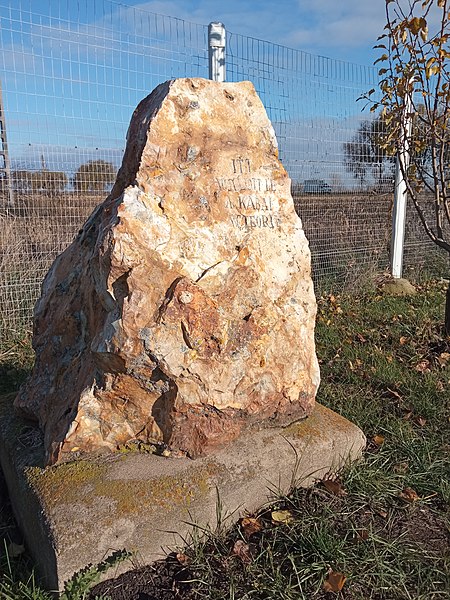
Magyar: Kaba határában, a meteorit valószínű hullás-helyének közelében elhelyezett emlékkő (Fotó: Nagy Mihály)
English: A memorial stone placed on the outskirts of Kaba, near the probable meteorite fall site (Photo: Mihály Nagy) |
| Date | |
| Source | https://www.flickr.com/photos/192723874@N06/52646919913/ |
| Author | Mihály Nagy |
| Camera location | | View this and other nearby images on: OpenStreetMap |
|---|
(1).jpg¶ms=047.380180_N_0021.276592_E_globe:Earth_type:camera__&language=en)
Licensing
| This image was originally posted to Flickr by namygy at https://flickr.com/photos/192723874@N06/52646919913. It was reviewed on 30 January 2023 by FlickreviewR 2 and was confirmed to be licensed under the terms of the Public Domain Mark. |
This work has been released into the public domain by the author on Flickr, where the author has declared it as a "Public Domain Work" and tagged it with the Creative Commons Public Domain Mark.
|
||
The Public Domain Mark (PDM) is not a copyright license, but a symbol used to indicate that a work is in the public domain. When it is applied by the author or the copyright holder, community consensus has decided such works as being public domain in the US and countries where it is legally possible to release own work to the public domain. In the countries where this is not possible, the copyright status of the work remains undetermined.
| ||
If a file is tagged with Public Domain Mark by someone other than the author or the copyright holder, a more specific copyright tag such as one found at Commons:Copyright tags/General public domain must be applied. If this is your own work, please use {{Cc-zero}} instead.
|
File history
Click on a date/time to view the file as it appeared at that time.
| Date/Time | Thumbnail | Dimensions | User | Comment | |
|---|---|---|---|---|---|
| current | 05:11, 30 January 2023 | | 3,120 × 4,160 (5.84 MB) | commons>Fatongu | Uploaded a work by Mihály Nagy from https://www.flickr.com/photos/192723874@N06/52646919913/ with UploadWizard |
File usage
There are no pages that use this file.
(1).jpg)